Flooding Hits Ucubamba, Paccha, and Ricaurte: Three Evacuated, Dozens of Homes Damaged
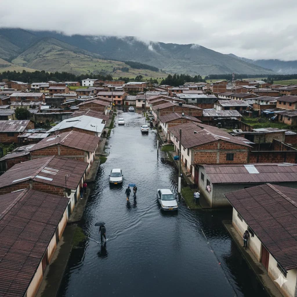
Heavy rains over the weekend sent rivers and streams surging across parts of eastern Cuenca, flooding homes in Ucubamba, Paccha, and Ricaurte and forcing the evacuation of three residents.
According to El Universo, a stream overflowed in the Ucubamba sector on Sunday, February 2, sending water into surrounding streets and homes. The Cuerpo de Bomberos de Cuenca responded to calls across all three neighborhoods. More than 12 homes sustained damage from the flooding.
What Happened
The immediate cause was a rapid rise in water levels in rivers and streams fed by sustained rainfall. In Ucubamba, a quebrada (stream) broke its banks, flooding nearby streets and entering ground-floor homes. Bomberos evacuated three people from affected residences.
The ECU 911 emergency coordination center reported additional flooding near the Gruta Señor de Burgos in Ricaurte, where multiple homes were waterlogged. Along the Panamericana Norte at the entrance to Paccha, the same overflowing quebrada caused road flooding and at least one home to flood.
This is not the first time these areas have flooded recently. Just a week earlier, on January 26, a similar heavy rainfall event caused a stream to overflow in Ucubamba, stranding a vehicle on the Tomebamba riverbank and triggering emergency responses across the city.
The Forecast: More Rain Through February 5
INAMHI has issued alerts warning that intense rainfall will continue across southern Ecuador through at least Wednesday, February 5. The current weather pattern is driven by the active phase of the Madden-Julian Oscillation (MJO), combined with moisture flowing in from the Amazon basin.
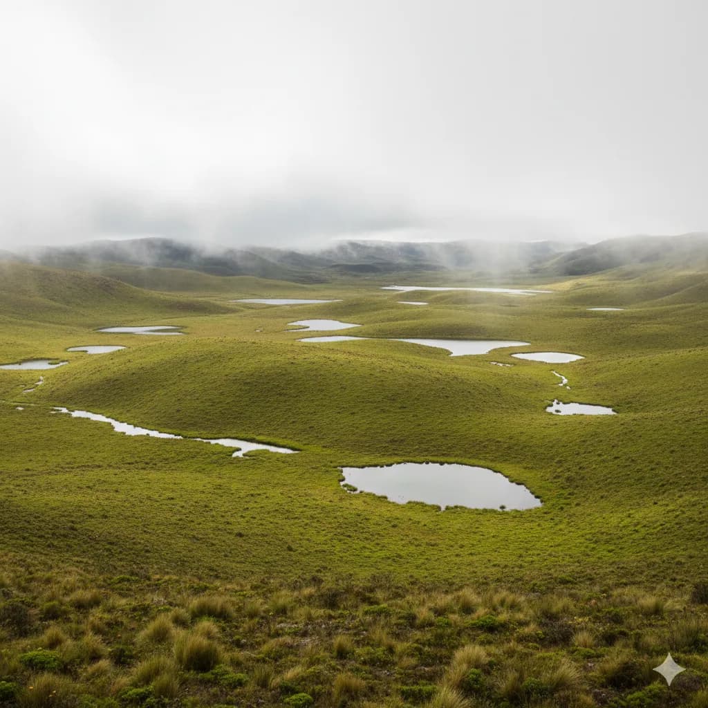
The agency warns of continued risk of landslides and river flooding, particularly along the Cordillera Oriental.
February, March, and April are historically Ecuador's highest-risk months for rain-related emergencies.
Why These Areas Keep Flooding
Ucubamba, Paccha, and Ricaurte sit along the eastern corridor where Cuenca's four main rivers converge to form the Río Cuenca. According to a risk analysis by Primicias, the confluence zone—including Ucubamba, Challuabamba, Guangarcucho, and El Descanso—is among the highest-risk flood areas in the canton.
Across urban Cuenca, approximately 2,191 buildings housing around 7,669 people sit within flood-susceptible zones. Some 113.5 kilometers of city roads are also at risk, including major routes like the Paseo Tres de Noviembre, Avenida 24 de Mayo, and the Cuenca-Azogues highway.
The highest-risk riverbanks are along the Yanuncay and Tomebamba, with known flood zones at Misicata, Tres Puentes, the Universidad del Azuay area, and Gapal.
What to Do If You Live in an Affected Area
- Move valuables and documents to upper floors or high shelves
- Don't drive through flooded streets — water depth is impossible to judge and vehicles stall quickly
- Call ECU 911 for emergencies
- Monitor ETAPA and INAMHI on social media for real-time alerts
- Know your nearest evacuation route — if water enters your home, leave immediately
- Bomberos Cuenca's Station 13 in Ucubamba was built specifically to improve response times for this area
Contact Numbers
- ECU 911 — Emergency coordination
- Bomberos Cuenca — Fire and rescue
- ETAPA EP — 188 (water and utility issues)
Sources: El Universo, Teleamazonas, ECU 911, Primicias, INAMHI

Chip Moreno
Founder of Cuenca Expat and longtime resident of Cuenca, Ecuador. Passionate about helping expats navigate life in this beautiful Andean city.